Treks La Gomera


Data sheet of the trail/hiking path 

Description
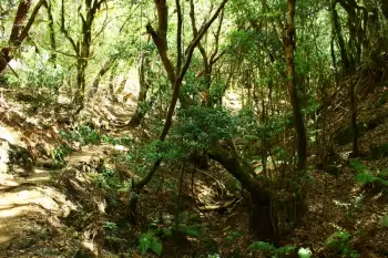
 La Ruta parte desde Risquillos de Corgo (1.060 m) una vez que tomamos la pista forestal que nos lleva hasta el área recreativa de Jardín de Las Creces. A partir de allí seguimos en suave descenso por el sendero GR-131 hasta Las Hayas. El recorrido es muy agradable para el caminante y discurre por un barranco que contiene fayal – brezal maduro y laurisilva de fondo de barranco húmedo. Durante la primavera podemos disfrutar de los tapices del geranio canario que decoran el sotobosque. En algunos tramos se ve el antiguo canal que conducía el agua desde el interior del bosque hasta a las fincas y casas limítrofes. Es posible incluso ver vestigios de antiguas terrazas de cultivo que se encontraban en explotación en el interior mismo del monte.
Al salir del límite del Parque Nacional de Garajonay la vegetación se aclara y el sendero sigue unos 500 metros entre cultivos de autoconsumo y viñas, hasta  llegar a Las Hayas (1.000 m). Se trata de un bonito caserío rodeado de palmeras y fayal-brezal, donde la ganadería ha sido la actividad económica tradicional más importante. Pasaremos junto a la Ermita de Nuestra Señora de Coromoto, con su plaza y área recreativa.
Tanto en las Hayas como en El Cercado encontramos buenas muestras de la arquitectura doméstica tradicional de las zonas rurales de La Gomera, cuyas características fundamentales son su integración en el entorno y su funcionalidad. Las casas son terreras (de una sola altura), con una o dos galerías en forma de L. Se distribuye de manera dispersa por el paisaje en el que se integra plenamente debido, entre otros factores, al acabado en piedra procedente de las inmediaciones. Es una vivienda funcional en la que se da cobijo a toda la familia, se almacenan cosechas o aperos y se resguardan los animales. Como elemento anejo al hogar es característico el horno doméstico, bien integrado en un lateral de la casa o aislado en las cercanías.
 Desde Las Hayas el sendero prosigue hasta El Cercado denominado como GR-131 y rodeado de palmeras, piteras, hierbas, tuneras, jaras, codesos y viñas. Antiguamente fue una zona de pastizal y cereales que se cultivaban en terrazas. El antiguo uso pastoril de la zona se atestigua en topónimos como el Mirador de Punta Belete, desde donde tenemos una generosa panorámica del Barranco del Agua, la parte alta de Valle Gran Rey y la Montaña de La Mérica.
Enseguida estamos en el Caserío de El Cercado, conocido, sobre todo, por su Centro Alfarero. En sus talleres se puede contemplar cómo las manos de las loceras trabajan el barro como lo hicieron sus antepasadas, desde antes incluso de la conquista de la isla por los castellanos. En el Centro de Interpretación "Las Loceras" se puede recibir mayor información sobre esta especialidad artesanal. El Cercado es visita obligada para el caminante que quiere descubrir La Gomera más auténtica.
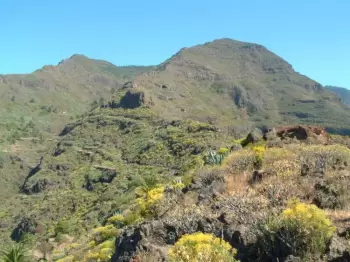
Cerca de la plaza del Cercado cogemos el sendero que nos lleva por el Barranco de La Matanza hasta la Degollada del Cerrillal o Chelé. Se trata de un  barranco interior, zona de pastoreo colgada entre los 1.000 m y los 650 m, en el límite superior de la vertiente sureste del Valle Gran Rey, lo cual nos permite disfrutar de magníficas panorámicas del mismo. Tras dejar atrás la Montaña del Adivino (858 m), lugar sagrado para los antiguos gomeros, descendemos con gran desnivel hasta la Ermita de Los Reyes, ya en Valle Gran Rey. Se trata de un templo de reducidas dimensiones que constituye el centro espiritual del municipio.
Desde Los Reyes seguiremos el sendero que discurre por el borde del barranco, para luego cruzarlo y llegar primero al barrio de La Calera y luego al de La Playa. Aquí termina la ruta, y el caminante puede descansar disfrutando del mar y la playa.
Feedback(0) 
Fotos de la ruta
Recommendation for hiking:
Consult previously the state of the hiking paths with the Cabildo


